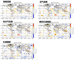
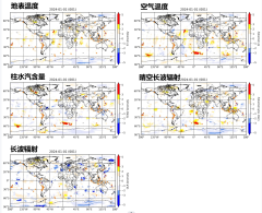
大气红外测深仪 (AIRS) 是极轨轨道平台 Aqua 上的光栅光谱仪。本数据集使用AIRS 3级每日网格产品计算得到。数据空间范围是全球,分辨率是1°。时间范围是从2002年8月31日至今,分辨率是1天。用于计算异常的参数包括地表温度、空气温度、柱水汽含量、OLR和晴空OLR。文件格式是GeoTiff,大小约为 1.2 MB。
本数据集使用偏移指数方法计算各参数的每日异常值,用于地震异常的监测预报。
焦中虎
是在卫星数据基础上的自主加工产品
中文:焦中虎,单新建,基于高光谱热红外AIRS数据的每日多参数异常数据集,2024.
英文:Zhonghu Jiao, Xinjian Sha (2024). Daily multi-parameter anomaly dataset based on hyperspectral thermal infrared AIRS data.
Jiao, Z.; Shan, X. Pre-Seismic Temporal Integrated Anomalies from Multiparametric Remote Sensing Data. Remote Sensing. 2022, 14, 2343.
Jiao, Z.-H.; Shan, X. Consecutive statistical evaluation framework for earthquake forecasting: Evaluating satellite surface temperature anomaly detection methods. Journal of Asian Earth Sciences: X. 2022, 7, 100096.
2024-11-18
2024-11-18
2024-11-18
2024-08-16
2024-08-16